What is it Like in the Northwest?
What are the neighborhoods like?
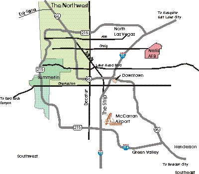
We are going to use the definition of the Northwest as North of Charleston and west of Decatur. There are others possible but this is a reasonable common one and define a pie shaped quadrant ot the Las Vegas Valley.
Here is a map that gives an idea of how the Northwest is situated in Las Vegas.

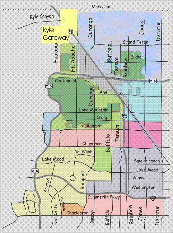
Here is the Northwest in a little more detail. We have broken it up into areas to give manageable pieces... Click the pieces to go to the various areas...
..

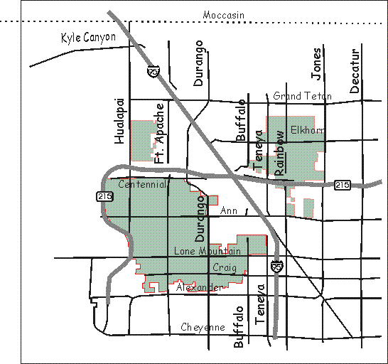
For a view of the northern end of the northwest Las Vegas Valley and the open space planned for it download this. It is also available at the governmental site with the latest upgrades here. They should be the same but sometimes government things vanish or get moved
There are also some limited areas of habitation around Kyle Canyon but that is kind of limited in scope and appeal. A brief introduction to the coming Kyle Gateway project is here.
One interesting feature of the Northwest are the Rural Neighborhood Preservation zones which cover a lot of the area...

The RNPs will also be discussed separately here.
We will look through the Northwest Las Vegas Valley from east to west and south to north. Or you can click on an area of interest and go right there.
The City of Las Vegas has also marked a large portion of this area as the town of Centennial Hills. We won't deal with this much except as individuals areas. But to see the City of Las Vegas view go here


